Land Surveys, Topographic Surveys, and Aerial Mapping
Topographic Surveys - No More Endless Walks
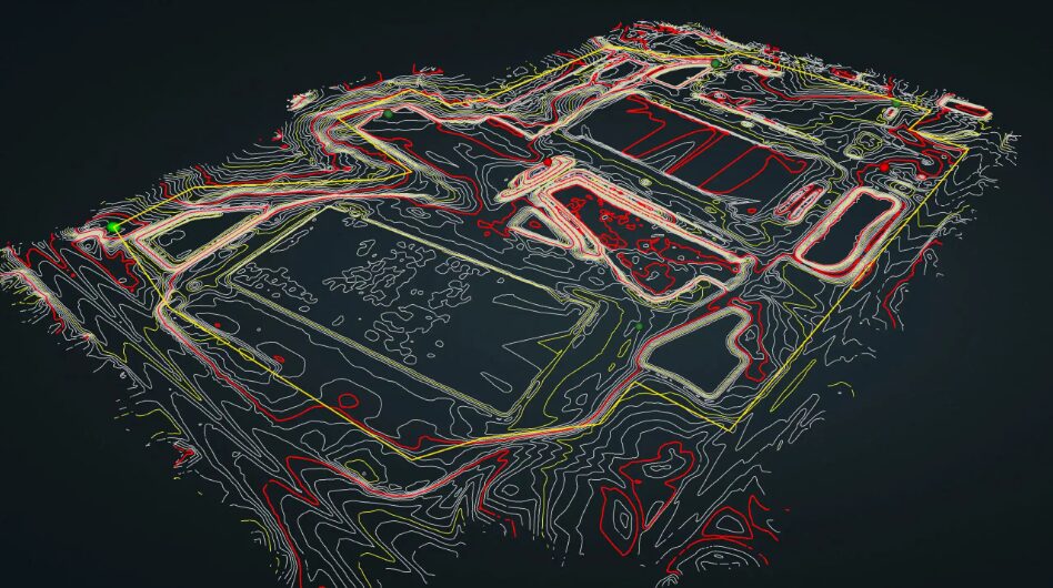
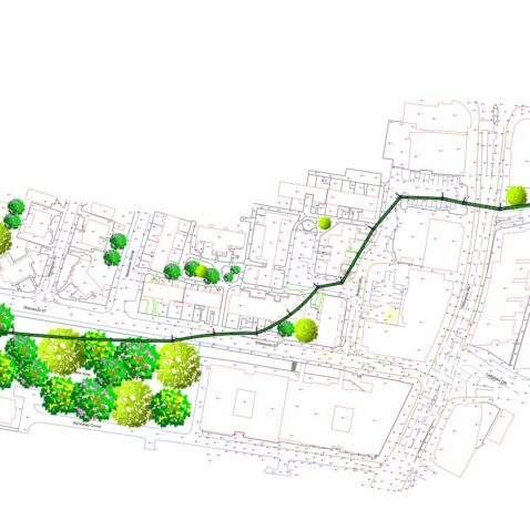
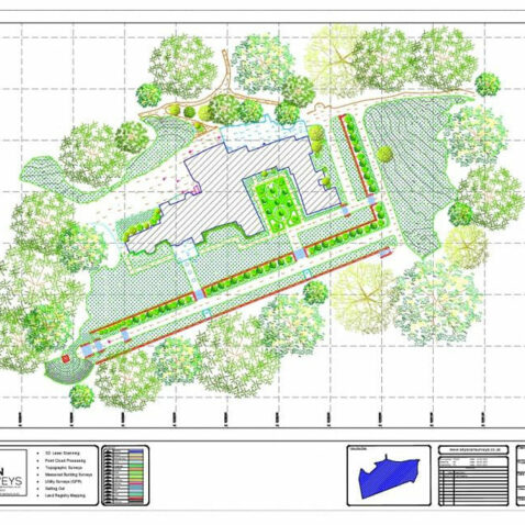
Leveraging cutting-edge technology and experienced professionals, Sky Scan Surveys emerges as your trusted partner for comprehensive land and topographic surveys. Our deliverables include DWG, Revit models, point clouds, contour maps, site plans, and more. We weave precision and efficiency into every project, employing top-tier drone technology and state-of-the-art equipment. This meticulous approach ensures consistently high-quality results, culminating in detailed topographic maps boasting high-level accuracy.
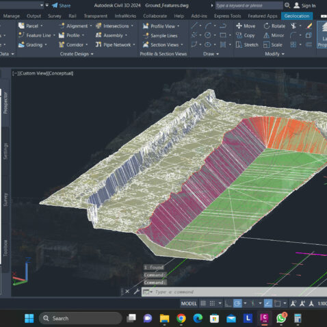
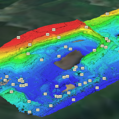
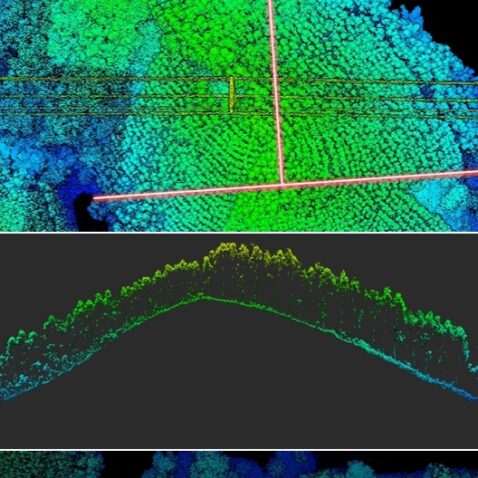
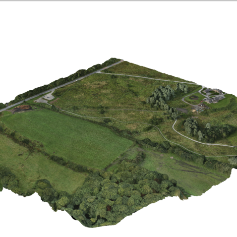
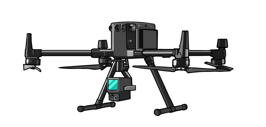
Transcending mere aerial imagery, our comprehensive service portfolio leverages advanced techniques like photogrammetry and LiDAR. These methodologies empower us to generate intricate 3D terrain models, unveiling invaluable insights that inform your decision-making process. Our solutions empower you with a holistic understanding of your land, its complexities, and its potential.
Step away from the limitations of traditional surveying methods and embrace the future with Sky Scan Surveys. We champion streamlined workflows, prioritise enhanced safety measures, and deliver cost-effective solutions tailored to projects of all scales and complexities.
Accurate & Efficient Topographic Land Surveys
Traditional land surveying and topographic methods, particularly in large or difficult-to-reach areas, are often time-consuming, inefficient, and tedious. Surveyors spend arduous hours trudging through terrain, exposing them to fatigue and increasing the risk of errors. Embracing modern technologies for topographic and land surveys revolutionises this process, streamlining data collection and enhancing accuracy.
But there’s a better way to rise above limitations. With state-of-the-art drone-powered topographic surveys, take flight to map your entire site with stunning 3D models and precise maps. Obtain seamless CAD deliverables for effortless design integration. Envision the time and resources saved, the accuracy gained, and the peace of mind in knowing your project starts on solid ground
Drone-powered aerial surveys offer a modern, faster, and more detailed solution to the problems of traditional land surveying and topographic methods.
Leave the limitations of traditional methods behind. Embrace the efficiency and precision of drone-powered topographic surveys.
Topographic Survey Experts: Fast, Reliable Results
Precision Mapping
Achieve centimeter-level accuracy with our drone surveys, ensuring data you can trust for informed decision-making. Precision mapping is essential for reliable and accurate survey results. Precision mapping is essential for reliable and accurate survey results.
Efficient Data Collection
Save time and resources by swiftly capturing extensive survey data, streamlining project assessments. This benefit emphasizes the efficiency of your surveying process, which can be a significant time and cost-saver for clients.
Inaccessible Area Reach
Access challenging or remote locations effortlessly, expanding the scope of surveying possibilities. This feature highlights the versatility of your services, making it possible to survey areas that are otherwise difficult to reach.
Enhanced Safety
Monitor project progress remotely, reducing on-site risks and enhancing safety measures. Safety is always a top concern in any project, and your ability to enhance it through remote monitoring is a compelling benefit.
Cost-Efficiency
Optimize resource allocation and reduce operational costs with our high-resolution drone surveys. Cost-efficiency is a key consideration for clients, and this feature demonstrates how your services can save them money.

Get Started Today
We're here to answer your questions and explore how our services can benefit your project. Don't hesitate to reach out to us via phone, email, or through our social media channels.
Drone-Powered Topographic Surveys: Features
- DSMs and DTMs
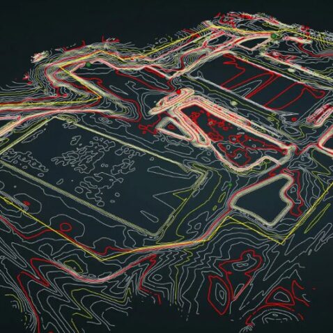
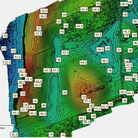
- Contour Maps
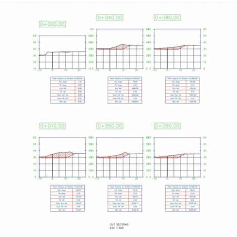
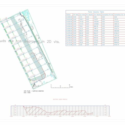
- Volume Calculations
- Point Clouds
- Feature Extraction in CAD
- 3D Models and Animations
Topographic Survey - Case Study
Quarry Management Transformation
Montcliffe Quarry, Horwich, Greater Manchester
Challenge
The challenge at hand was to modernise quarry management while ensuring safety, particularly in the context of a hazardous cliff that made traditional surveying methods risky and inadequate. The quarry sought a solution to optimize operations and improve overall efficiency.
Solution
To address this challenge, the quarry adopted drone-based surveying techniques. This innovative approach aimed to conduct comprehensive aerial surveys of the quarry, covering various aspects such as assessing the cliff’s fall hazard, stockpile assessments, and grade plans. The primary objective was to enhance safety, efficiency, and data accuracy in quarry management.
Implementation
The transition to drone-based surveying was seamlessly executed. A significant advantage was the ability to launch the drones from a safe location, enabling surveys of the cliff and the entire site from up to 50 meters above ground. This transition was underpinned by three key aspects:
Using advanced surveying drones, we deliver high-quality results. Say goodbye to limitations, and contact us for a consultation or proposal to elevate your projects.
Frequently Asked Questions
High-Resolution Mapping with Photogrammetry & LiDAR
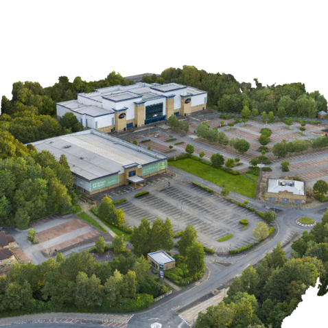
Our photogrammetry maps and survey data deliver exceptional detail, capturing features between 0.67 and 3cm per pixel (0.67 cm - 3 cm GSD). This data is transformed into detailed 3D terrain models, including Digital Surface Models (DSMs) and Digital Terrain Models (DTMs).
For unparalleled precision, especially in areas with dense vegetation, we offer LiDAR surveys. These surveys achieve an impressive horizontal accuracy of 5cm at 150m and vertical accuracy of 4cm at 150m.
While LiDAR excels in challenging environments, our standard 3D models and point clouds generated through photogrammetry demonstrate impressive accuracy as well. Their horizontal accuracy ranges from 15 to 30mm, and vertical accuracy from 30 to 70mm. Utilising ground control points can further enhance this accuracy for both photogrammetry and LiDAR surveys.
Aerial surveys offer several advantages, including higher accuracy, faster data collection, access to inaccessible areas, enhanced safety, and cost-efficiency. These benefits make them a superior choice for many projects.
Yes. Sky Scan Surveys holds operational authority granted by the Civil Aviation Authority (CAA) to conduct commercial operations. Additionally, we maintain public liability insurance coverage of up to 5 million, ensuring peace of mind for our clients and the safety of every project we undertake.
Aerial surveys are versatile and can be applied to a wide range of projects, including topographic mapping, infrastructure development, environmental monitoring, and more.
With our efficient data collection methods, we can deliver survey results promptly, minimizing project downtime and accelerating decision-making.
Yes, aerial surveying is a safe alternative to traditional methods, as it eliminates the need for personnel to work in precarious conditions. We prioritize safety in all our operations.
Certainly! Our drone fleet's versatility allows us to adapt to projects of any scale, making our services accessible for all.
To request an aerial survey, simply contact us for a consultation. We'll discuss your project's specific requirements and tailor a solution to meet your needs.
The cost of our services varies based on project specifics. Contact us for a free consultation and proposal to get a precise estimate for your project.

