Drone Survey, LiDAR & Measured Building Survey Costs | UK 2026
Sky Scan Surveys publishes transparent pricing for every survey service we offer — drone surveys, LiDAR surveys, measured building surveys, topographical surveys and scan-to-BIM. Costs depend on project size, site complexity and deliverable format. Use the table below for a quick comparison, or read on for a full breakdown.
Survey Cost Overview
All prices exclude VAT. Costs vary by site size, access, complexity and deliverable
format. Not sure which survey you need? Talk to us — we will tell you the right option
for your project.
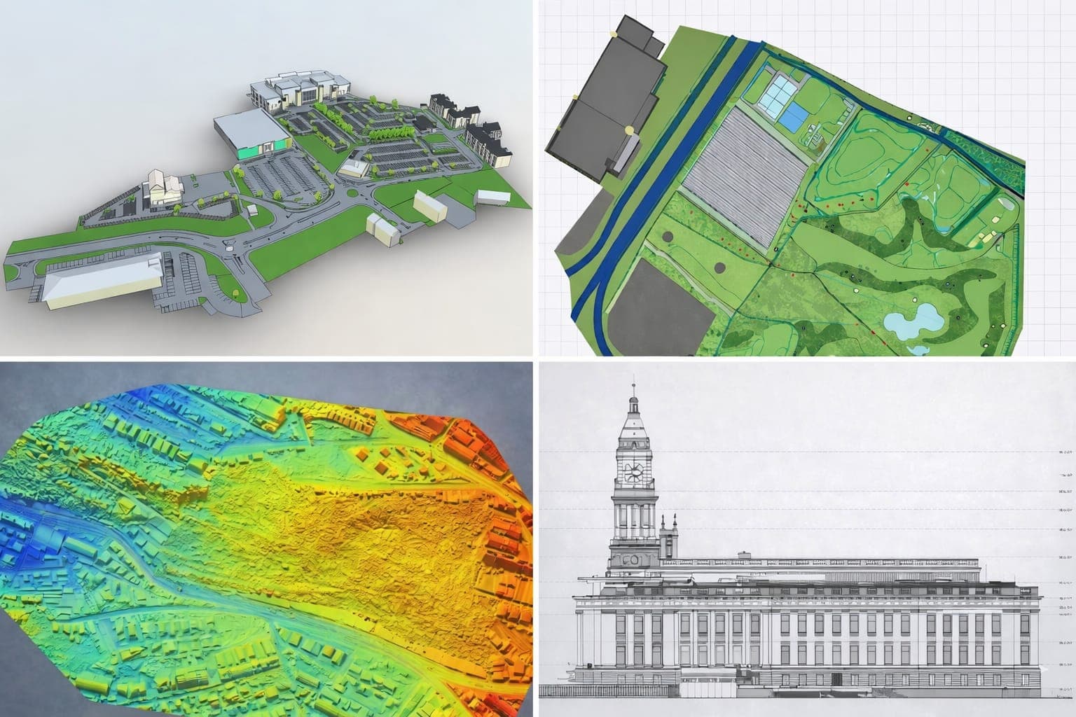
What Does a Drone Survey Cost?
A professional drone survey typically costs between £195 and £5,000, depending on the survey area (in hectares), ground control point density, processing type and deliverable format. Small residential and commercial roof surveys start from £195. Large infrastructure, volume calculation or photogrammetric mapping projects with full point cloud processing start from £1,200.
- Survey area — larger sites cost more (priced per hectare)
- Deliverable type — orthomosaic map, point cloud, 3D model, video report
- Ground control points — more GCPs = higher accuracy = higher cost
- Post-processing — raw images vs processed CAD/DEM outputs
- Access and flight restrictions — urban areas or restricted airspace add cost
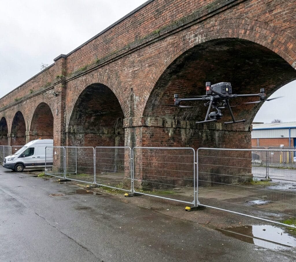
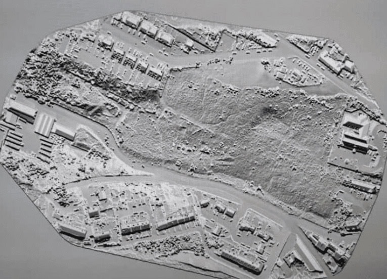
LiDAR Survey Pricing
LiDAR surveys range from £1,200 to £5,000 per project, depending on scan area, required point density (pts/m²), site obstruction level and whether a classified point cloud or full 3D mesh is required. Heritage building scans typically start from £2,500. Large industrial or infrastructure sites with dense vegetation begin at £4,000.
- Point density required — higher pts/m² = longer scan time = higher cost
- Site obstruction — dense vegetation, narrow spaces or multi-level structures add time
- Output format — classified point cloud, 3D mesh, BIM-ready data or DEM
- Scan extent — single building vs multi-structure estate or linear infrastructure
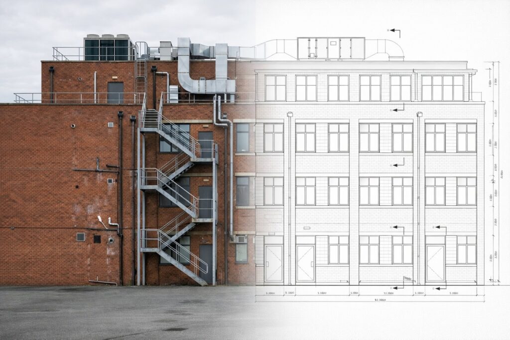
Measured Building Survey Cost
Measured building surveys cost between £350 and £3,000 per floor for most commercial and residential properties. Key price drivers are floor count, ceiling height and complexity, LOD specification (LOD 2 vs LOD 3) and output format (CAD, BIM or PDF). We offer same-week booking for most projects.
- Floor count — each floor is priced separately; discounts for multi-floor jobs
- Level of Detail (LOD) — LOD 2 (basic floorplan) to LOD 3 (full structural detail)
- Output format — PDF only vs AutoCAD DWG vs full Revit BIM model
- Ceiling complexity — high ornate ceilings, mezzanines, irregular geometry add time
- Turnaround — express delivery (same week) may carry a small premium
Topographical Survey Cost
Topographical surveys start from £350 to £3,000 per hectare. Price is driven by terrain complexity, survey scale (1:200 or 1:500), spot height density and deliverable format (DWG, PDF or DEM). Urban sites with significant obstruction typically add 20–30% to standard rates.
- Site area — charged per hectare; larger areas unlock lower per-ha rates
- Survey scale — 1:200 requires more shots than 1:500; more time = more cost
- Terrain type — flat open land is fastest; sloped, wooded or obstructed land costs more
- Deliverable — contoured DWG, 3D DEM, full PDF report or BIM-compatible format
Scan to BIM Pricing
Scan-to-BIM projects cost between £600 and £1,200 per floor, depending on your LOD specification (LOD 2, LOD 3 or LOD 4), output format (Revit, ArchiCAD or IFC) and coordination modelling requirements. Ground-floor BIM feasibility scans for planning or refurbishment projects are available from £600. LOD 3 and above requires on-site LiDAR scanning.
| LOD Level | What It Includes | Typical Cost / Floor | Best For |
|---|---|---|---|
| LOD 2 | Basic geometry, major elements, no MEP detail | £600 – £800 | Planning applications, feasibility |
| LOD 3 | Full geometry, MEP rough-in, wall build-up | £800 – £1,000 | Refurbishment, RIBA Stage 3 |
| LOD 4 | Full MEP, structural, shop-drawing ready | £1,000 – £1,200 | Construction, coordination modelling |
Scan to BIM service page →
What's Included in Your Quote?
Every Sky Scan Surveys quote is fully itemised. Here is what we include as standard
across all our survey services:
| Full site visit | CAA-licensed pilot / RICS-affiliate surveyor |
|---|---|
| Professional indemnity insurance | covered on every project |
| Data processing | all raw data processed to your specification |
| Deliverable files | in your required format (DWG, PDF, IFC, RVT, LAS, GeoTIFF) |
| Revision round | one round of amendments included |
| Direct contact | you deal with the surveyor, not a call centre |
Why Choose Sky Scan Surveys?
- CAA-licensed drone operators — legally required for commercial drone work
- Professional indemnity insurance on all projects
- UK-wide coverage — Bolton-based, nationally operating
- GDPR compliant data handling
- Direct surveyor contact — no call centres or subcontractors
- Same-week availability on most projects
Request a Quote
Tell us about your project and we will respond with a fully itemised quote within 24 hours. All enquiries are handled directly by our survey team — no sales calls.
Frequently Asked Questions About Survey Pricing
How quickly can I get a quote?
We aim to respond to all quote requests within 24 hours on working days. For straightforward projects, we can often provide a same-day indicative price by phone or email. Submit our contact form with your project details and we will get back to you promptly.
Do survey prices include VAT?
No. All prices shown on this page exclude VAT. VAT is added at the standard UK rate (currently 20%) and will be shown separately on your formal quotation.
Can I get a fixed-price quote for my survey?
Yes. For most standard projects, we provide a fixed-price quote before work begins. The price is confirmed in writing before we proceed. Price variations only occur if site conditions change significantly from what was described at quote stage (for example, unexpected access restrictions or a change in deliverable specification).
What is the difference between a drone survey and a LiDAR survey?
A drone survey uses photogrammetry (camera-based) to produce orthomosaic maps, point clouds and 3D models from aerial images. LiDAR (Light Detection and Ranging) uses laser pulses to measure distances with higher accuracy, particularly useful in areas with vegetation, complex geometry or where millimetre-level accuracy is needed. Many projects use both methods. We will recommend the right approach for your site.
How much does a scan-to-BIM survey cost for a single floor?
A single-floor scan-to-BIM project starts from £600 for LOD 2 specification (basic geometry for planning or feasibility). LOD 3 delivery (full structural and MEP rough-in) for a single floor typically costs £800–£1,000. See our Scan to BIM pricing table above for a full LOD breakdown.
Do you survey outside of Bolton and the North West?
Yes. We operate across England, Wales and Scotland. Our drone and LiDAR survey teams regularly work in London, the Midlands, Yorkshire, the South West and Scotland. Travel costs for sites beyond 50 miles of our Bolton base may apply and will be included in your quote.